ZIP Code 5: 70070 - LULING, LA
ZIP Code 70070 is the postal code in LULING, LA. Besides the basic information, it also lists the full ZIP code and the address of ZIP code 70070. Whatsmore, there is more information related to ZIP Code 70070. For example, nearby ZIP code around ZIP Code 70070, etc.
ZIP 70070 Basic Information

The basic information of ZIP Code 70070 is as follows, including: country, county, city, FIPS and etc.
| State | County | City | ZIP Code 5 |
|---|---|---|---|
| LA - Louisiana | St. Charles Parish | LULING | 70070 |
What is the plus 4 zip code for 70070 ZIP Code? Below is the detail.
70070 ZIP+4 Code List

What are the 4 digit zip extensions of ZIP Code 70070? ZIP code 70070 has many plus 4 codes, and each plus 4 code corresponds to one or more addresses. Below we list all the ZIP+4 codes and their addresses in the ZIP Code 70070. You can find a 9-digit ZIP Code by a full address.
| ZIP Code 5 Plus 4 | Address |
|---|---|
| 70070-0321 | PO BOX 321 (From 321 To 440), LULING, LA |
| 70070-0441 | PO BOX 441 (From 441 To 560), LULING, LA |
| 70070-0561 | PO BOX 561 (From 561 To 680), LULING, LA |
| 70070-0681 | PO BOX 681 (From 681 To 800), LULING, LA |
| 70070-0801 | PO BOX 801 (From 801 To 920), LULING, LA |
| 70070-0921 | PO BOX 921 (From 921 To 979), LULING, LA |
| 70070-0981 | PO BOX 981 (From 981 To 1100), LULING, LA |
| 70070-1101 | PO BOX 1101 (From 1101 To 1116), LULING, LA |
| 70070-1117 | 400 (From 400 To 499) COVE POINTE DR, LULING, LA |
| 70070-1118 | 300 (From 300 To 399) COVE POINTE DR, LULING, LA |
Post Office in ZIP Code 70070

LULING is the only post office in ZIP Code 70070. You can find the address, phone number, and interactive map below. Click to view the service and service hours about LULING.
-
LULING Post Office

Address 1363 PAUL MAILLARD RD, LULING, LA, 70070-9998
Phone 985-785-7184
*Lot Parking Available
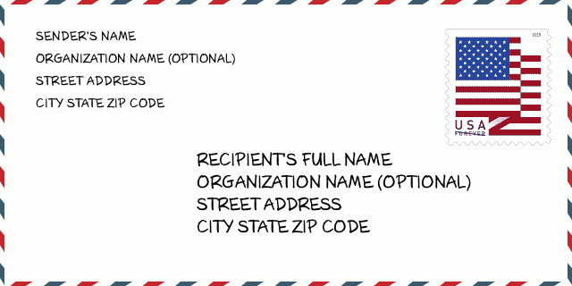
How to write a U.S. envelope?

-
First, you need to fill in the recipient's mailing information in the center of the envelope. The first line is the recipient's name, the second line is the street address with a detailed house number, and the last line is the city, state abbr, and ZIP Code.
Second, write the sender's information on the left top corner of the envelope. If your mail cannot be delivered, it will return to the sender's address.
Finally, don't forget to stick the stamp on the right top corner. Otherwise, the letter will not go into the delivery process.
Here is the envelope example below.
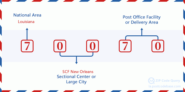
What does each digit of ZIP Code 70070 stand for?
-
The first digit designates a national area, which ranges from zero for the Northeast to nine for the far West.
The 2-3 digits represent a sectional center facility in that region.
The last two digits designate small post offices or postal zones.
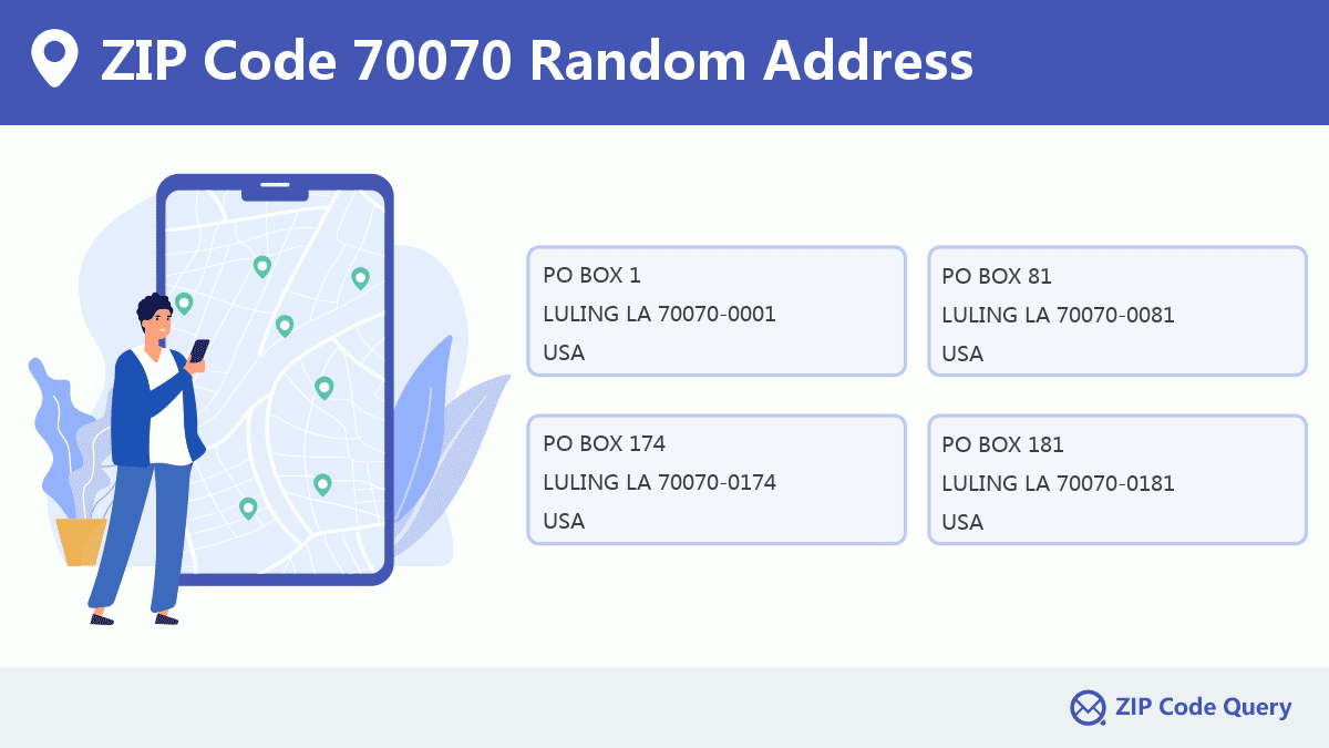
Random Address in ZIP 70070

ZIP Code 70070 has 1,585 real random addresses, you can clicking the picture below to get random addresses in ZIP Code 70070.
ZIP 70070 Online Map

This is online map of the address LULING, St. Charles Parish, Louisiana. You may use button to move and zoom in / out. The map information is for reference only.
ZIP 70070 NearBy ZIP Code
The Nearby ZIP Codes are 70039, 70078, 70080, 70047, and 70087, you can find ZIP codes in a 25km radius around ZIP Code 70070 and the approximate distance between the two ZIP codes.
The data has a slight deviation for your reference only.
| ZIP Code | Distance (Kilo Meters) |
|---|---|
| 70039 | 4.014 |
| 70078 | 7.379 |
| 70080 | 8.346 |
| 70047 | 8.948 |
| 70087 | 10.028 |
| 70057 | 10.678 |
| 70031 | 10.795 |
| 70141 | 13.53 |
| 70062 | 13.656 |
| 70063 | 14.915 |
| 70064 | 14.915 |
| 70030 | 15.6 |
| 70094 | 15.768 |
| 70123 | 16.01 |
| 70097 | 17.694 |
| 70069 | 20.198 |
| 70121 | 20.745 |
| 70001 | 20.899 |
| 70079 | 21.06 |
| 70096 | 21.576 |
| 70049 | 21.655 |
| 70004 | 21.975 |
| 70009 | 21.975 |
| 70010 | 21.975 |
| 70011 | 21.975 |
| 70033 | 21.975 |
| 70055 | 21.975 |
| 70060 | 21.975 |
| 70118 | 23.581 |
| 70072 | 24.686 |

Hospital in ZIP Code 70070

-
ST CHARLES PARISH HOSPITAL
Phone: (985) 785-3644Type: Acute Care HospitalsAddress: 1057 PAUL MAILLARD ROAD, LULING LA 70070, USA
Library in ZIP Code 70070

-
WEST REGIONAL LIBRARY
Phone: (985) 785-8471Address: 105 LAKEWOOD DRIVE, LULING LA 70070, USA
Comment


Add new comment